In order to use this website you need to accept the use of Cookies , our Privacy Policy , and our Terms and Conditions.
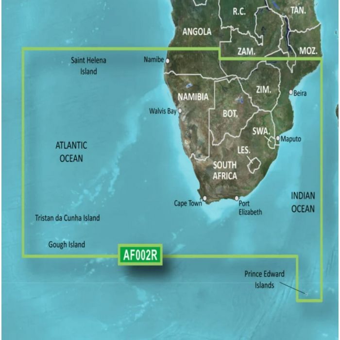
Garmin BlueChart G3 Vision Africa, South Coastal and Inland Chart - SD Card
- Shallow Water Shading feature
- Derived from official charts and private sources
- Depth Range Shading


Description
The Garmin BlueChart G3 Vision Africa, South Coastal and Inland Chart - SD Card is an advanced and feature-rich navigation tool designed specifically for mariners exploring the South coastal and inland regions of Africa. Packed with cutting-edge features and accurate data, it provides an unparalleled boating experience.
One of the standout features of this chart is the high-resolution relief shading, which offers a visually stunning representation of the underwater terrain. This feature brings the waterways to life, allowing mariners to navigate with confidence by providing a realistic and detailed view of the seabed contours.
Depth range shading is another powerful feature of this chart. It visually displays varying depth ranges, making it easy for mariners to quickly identify specific depth contours and select the most suitable routes for their journey. With the ability to display up to 10 depth ranges, this feature offers granular depth information to enhance navigation accuracy. The chart also provides up to 1-foot contours, enabling mariners to have a highly detailed understanding of the underwater landscape. By accurately depicting changes in water depth, these contours assist in identifying potential hazards, planning fishing spots, and locating anchorages.
Shallow Water Shading is incorporated into this chart, enhancing safety by clearly highlighting shallow areas and potential obstacles. Mariners can easily identify and avoid shallow waters, ensuring a smooth and risk-free boating experience. With the MarinerEye view, users can enjoy a 3D-like perspective of the waterways, providing a comprehensive overview of their surroundings. This view assists in navigation by offering a detailed representation of the coastline, landmarks, and navigational aids.
The chart offers worldwide coverage, making it a versatile solution for mariners exploring various regions across the globe. Whether venturing along the South coast and inland areas of Africa or embarking on international voyages, this chart provides reliable and comprehensive data.
The FishEye view provides an underwater perspective, giving mariners the ability to locate fish-holding structures, reefs, and other underwater features. This view is particularly valuable for anglers, enabling them to identify prime fishing spots with ease. To further enhance the navigational experience, this chart includes high-resolution satellite imagery and aerial photography. These features provide an incredibly detailed and realistic view of the surroundings, allowing mariners to easily recognize landmarks, coastlines, and other distinctive features.
Features
- Auto Guidance
- High resolution relief shading
- Depth range shading
- Depth range shading for up to 10 depth ranges
- Up to 1-foot contours
- Detailed contours
- Shallow Water Shading
- MarinerEye view
- Worldwide coverage available
- FishEye view
- High-resolution satellite imagery
- Aerial photography
Specifications
| Type | Chart |
| Place | Africa, South Coastal |
| Brand | Garmin |
| Model | BlueChart G3 Vision |
| Free Shipping | No |
|---|


