In order to use this website you need to accept the use of Cookies , our Privacy Policy , and our Terms and Conditions.
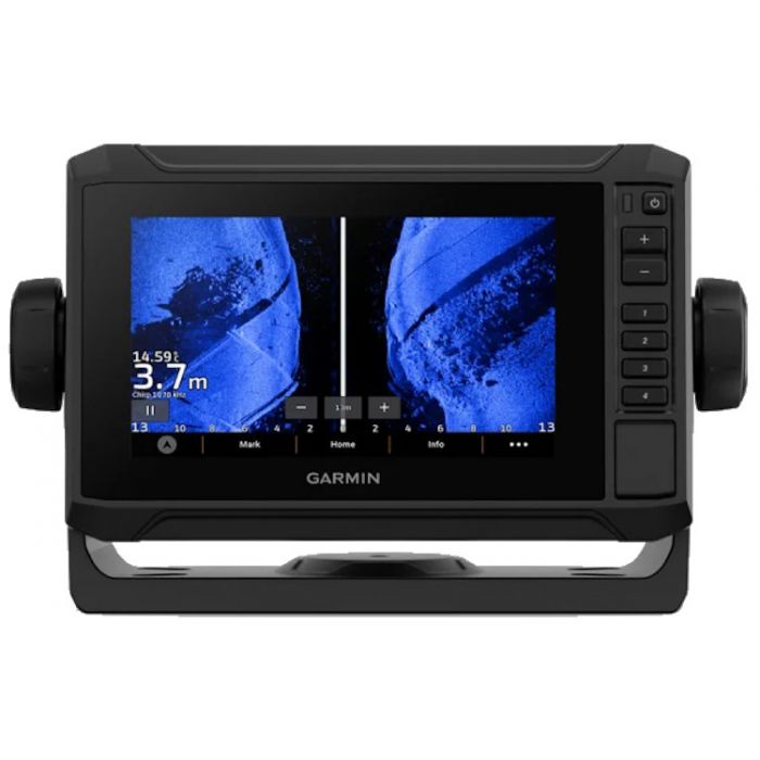
Garmin Echomap UHD2 Fishing Chartplotteer With GT54UHD-TM Transducer - Black, 6"
- High-resolution touchscreen display
- Ultra High-Definition (UHD) sonar
- Preloaded BlueChart g3 coastal charts
- Wi-Fi connectivity


Description
The Garmin Echomap UHD2 Fishing Chartplotteer With GT54UHD-TM Transducer - Black, 6" are powerful marine navigation devices designed to enhance your boating experience. With a sleek and compact 6-inch display, these chartplotters offer a wealth of features and advanced technology to help you navigate and explore the waterways with confidence.
Featuring a high-resolution touchscreen display, the ECHOMAP UHD2 chartplotters provide clear and vivid visuals, making it easy to read charts, maps, and other important information. The intuitive interface allows for effortless interaction, enabling you to access various functions and settings with just a few taps.
One of the stand-out features of the ECHOMAP UHD2 chartplotters is the built-in Ultra High-Definition (UHD) sonar capabilities. This advanced sonar technology delivers incredibly detailed and precise imaging of the underwater environment, allowing you to identify structures, contours, and fish with exceptional clarity. Whether you're fishing, cruising, or simply exploring, the UHD sonar provides valuable insights to enhance your time on the water.
The chartplotters come preloaded with Garmin's BlueChart g3 coastal charts, which provide detailed and up-to-date mapping information. These charts offer coverage for the coastal waters, including harbors, marinas, and other points of interest. With integrated Wi-Fi connectivity, you can easily access the latest software updates, download additional charts, and share waypoints and routes with other compatible Garmin devices.
In addition to the powerful navigation features, the ECHOMAP UHD2 chartplotters offer a range of useful tools and functions. They come equipped with a GPS receiver, allowing for accurate positioning and navigation. You can create and save custom routes, mark waypoints, and even track your speed and heading. The chartplotters also support optional accessories, such as radar, AIS, and autopilot, expanding their functionality even further.
Features
- High-resolution touchscreen display
- Ultra High-Definition (UHD) sonar
- Preloaded BlueChart g3 coastal charts
- Wi-Fi connectivity
- GPS receiver
- Compatible with optional accessories
- Rugged and water-resistant design
- User-friendly interface
- Compatible with ActiveCaptain app
Specifications
| Touchscreen | /Yes |
| Input | Touchscreen With Keyed Assist |
| Accepts Data Cards | 1 Microsd Card, 32 Gb Maximum Size |
| Waypoints | 5 000 |
| Track Points | 50 000 |
| Tracks | 50 Saved Tracks |
| Navigation Routes | 100 |
| Has Built-in Receiver | Yes |
| Receiver | 10 Hz |
| Nmea 2000 Compatible | Yes |
| Gps | Yes |
| Glonass | Yes |
| Galileo | Yes |
| Beidou | Yes |
| Supports Waas | Yes |
| Supports Multi-band, Multi-constellation GPS | Yes |
| Built-in Auto Guidance+ | Yes (Downloadable Via Activecaptain App) |
| Garmin Navionics+ Inland & Coastal | Yes (See Additional) |
| Garmin Navionics+ (Coastal) | Yes (See Additional) |
| Garmin Navionics+ (Inland) | Yes (See Additional) |
| Tide Tables | Yes (See Additional) |
| Garmin Navionics+ | Yes |
| Garmin Navionics Vision+ | Yes |
| Topo | Yes |
| Standard Mapping | Yes |
| Garmin Quickdraw Contours | Yes |
| AIS | Yes |
| DSC | Yes |
| Supports Fusion-link Compatible Radios | Yes |
| Activecaptain Compatible | Yes |
| Sailing Features | Yes |
| Displays Sonar | Yes |
| Power Output | 500 W |
| Traditional Sonar (Dual Frequency/Beam) | Built-in (Single Channel Chirp, 50/77/83/200 Khz, L, M, H Chirp) |
| Clearv | Built-in 260/455/800/1000/1200 Khz |
| Sidev | Built-in 260/455/800/1000/1200 Khz |
| Panoptix Sonar | Yes |
| Livescope | Yes |
| Nmea 2000 Ports | Yes |
| Garmin Marine Network Ports | 1 |
| 12-pin Transducer Ports | 1 |
| Bluetooth Pairing | Yes |
| Ant+ (Connectivity) | Yes |
| Garmin Wi-fi Network (Local Connection) | Yes |
| Power Input | 9 To 18 Vdc |
| Typical Current Draw At 12 Vdc | 1.53 A |
| Maximum Current Draw At 12 Vdc | 3.2 A |
| Maximum Power Usage At 10 Vdc | 18.4w |
| Free Shipping | No |
|---|


